

Türkçe versiyonu için tıklayınız.
The Strandja Massif is located in the NW part of Turkey. The massif is bounded by the Thrace basin to the south, the Istanbul Zone to the east and the Black Sea to the north. It is roughly a NW-SE trending mountain belt, ca. 200 km long and 90 km wide.
The Strandja Massif mainly consist of two assemblages (the basement and the cover), which can be distinguished to each other with their rock association, age, and
pre-metamorphic unconformity defined between them. The basement constitutes Paleozoic metasediments (bioitite and garnet-biotite schists) and orthogneisses (hornblende-biotite, biotite-muscovite, and muscovite orthogneisses) whereas the cover association compound of Mesozoic metaclastic rocks.
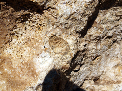
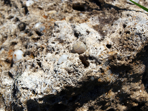
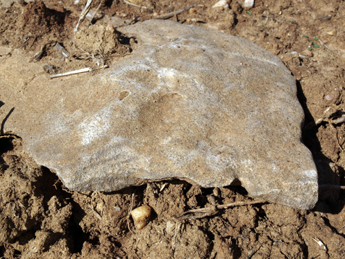
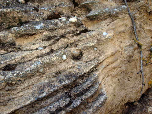
Limestones of Strandja
The coastal deposits along the southern slopes of the Strandja Massif indicate the presence of shallow marine depositional environments in the area. The quartz sand rich detrital deposits should correspond to depositional environments in bays, while the oolitic limestones are probably deposited in flat shelves with tides. The occurrence of Congeria rich limestones suggests also lagunal depositional environments. The lignite formation usually occurs in swamp areas, in marshy basins behind the coastline. There are two lignite mines next to our vineyards.
The Islambeyli Limestone Formation overlies with angular unconformity the magmaticmetamorphic rocks of the basement. Its type section is in the near Islambeyli village. It’s thickness may reach 100 m.
The recifal Kirklareli (Sogucak) Limestones transitionally covers the detrital Islambeyli Formation. In the vineyard locality, the Islambeyli Formation shows a succession of badly lthified pebble conglomerates, sand-siltstones, clays and limestones and its thickness is about 40 m. The limestone horizons are rich in well-preserved gastropods, pelecypods, echinids, corals (individual and colonies) and foraminifera. All horizons show an intense bioturbation. The horizon is also rich in nummulites. The Islambeyli Formation and Kirklareli Limestones (Sogucak Limestones) should be of early Oligocene in age.
Strandja Climate
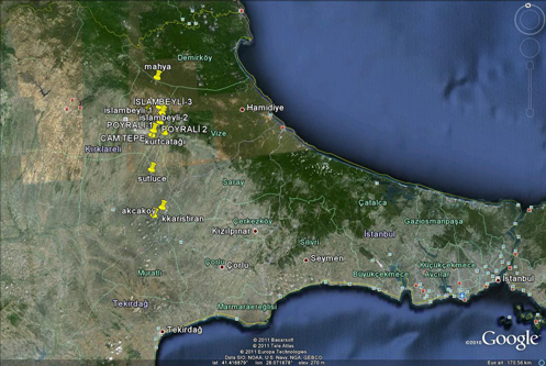
Our vineyards’ climate is influenced by three surrounding seas (Black Sea, Marmara Sea and Agean Sea). However, the Strandja Massif defines the differences among them. Annual rainfall: 600-800 mm. No irrigation except in Akcakoy vineyard.
Istranca Plateau: Akoren and İslambeyli vineyards. The humid climate of the Black Sea clashes with Thrace’s more continental regime in this area. Mean average annual temperature: 12 degrees. Mean August temperature: 21.2 degrees.
Prevailing wind: NE, 4-5 metres/second during the hottest part of the day.
Poyrali Canyon Creek Climate: Parpara, Duzdag, and Kartaltepe vineyards. Continental climate. Mean average annual temperature: 11.5 degrees.Mean August temperature: 20.7 degrees. Prevailing wind: NE, 4-5 metres/second during the hottest part of the day.
Poyrali, Sogucak, and Tozaklı vineyards: Continental Thracian climate. Mean average annual temperature: 12.1 degrees. Mean August temperature: 21.5 degrees.
Prevailing wind: NE, 5-6 metres/second during the hottest part of the day.
Sutluce, Kuçukkariştiran, and Akçakoy vineyards: Continental Thracian Climate. Mean average annual temperature: 12.5 degrees. Mean August temperature: 22.2 degrees.Prevailing wind: NE, 5-6 metres/second during the hottest part of the day.
Annual rainfall is between 600 and 800 mm depending on the location. No irrigation, dry farming in all vineyards.

 |